Getting started \ Data Hubs
 Data hubs are online catalogs that contain collections of satellite data, their aim is to connect users to the data by centralizing and cataloging it. Data hubs are generally focused either on a precise thematic topic or designed to provide generic data access via APIs.
There are various levels of data range and services: some platforms include tools to preprocess the data, others offer only a limited spatial coverage or data within a certain specific time frame. Some hubs allow for data visualization while others are only designed for quick-looks and downloads.
The next sections explain how these data hubs generally work, and give you some links to main data hubs, depending on the kind of data or kind of usage you are looking for.
How to use Data Hubs?
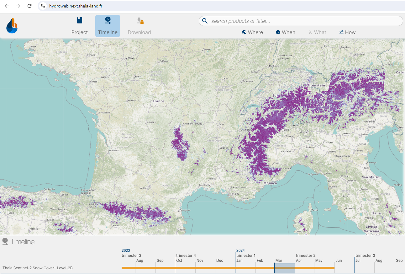
Usually, data hubs allow browsing datasets without being registered. They often provide a map based visualization of products being available, as can be seen in this Hydroweb Next screenshot:
In order to access other functionnalities, such as downloading or on demand processing if available, user must create an account. Downloading can often be done using the website, but also through other APIs allowing to query a catalog (through Opensearch or STAC), and then automatically retrieve products by giving some token or through another authentication method.
High resolution open products (SITS: Satellite Image Time Series)
This section gives an overview of main data hubs providing free to use High Resolution Satellite products, e.g. mainly Sentinel or Landsat data and related products.
| Catalog | Data collection | Key features | Services |
|---|---|---|---|
| GEODES | Sentinel1/2, SPOT, Landsat, Venus, etc. | MAJA L2A preprocessing | Visualization & download, ad hoc processing |
| Theia Land | Sentinel, Landsat and other L2 products. Hydrology | Will be replaced by Geodes and Hydroweb.next | Visualization & download |
| hydroweb.next | SWOT, Hydrology products | Visualization & download, interactive analysis | |
| Copernicus Land | |||
| Copernicus Data Space Ecosystem | Sentinel and associated datasets | Interactive analysis and lot of collections | Visualization, interactive analysis |
| Spot World Heritage | Spot 1-5 L1A | Download | |
| USGS Earth Explorer | Landsat and associated | Visualization & download | |
| Planetary Computer | Sentinel, Landsat and Open Data | Interactive analysis using Pangeo Stack | Visualization & download, interactive analysis |
| Wekeo | Copernicus and Sentinel Data | Meteorological data ECMWF | Visualization & download |
| Google Earth Engine | All open Data | Stream online computing | Visualization and interactive analysis |
Very High Resolution optical products (VHR)
This section explains how to get Very or Extra High Resolution optical products, like Pleiades or Pleiades Neo images.
| Catalog | Data collection | Key features | Services |
|---|---|---|---|
| DINAMIS | Pléiades, Spot 6/7, etc. | Some Spot6/7 as OpenData |
Altimetry
Altimetry are another kind of product, used for oceanography and inland hydrology. Most well known products are Jason products and more recently SWOT data.
| Catalog | Data collection | Limitations | Features / services |
|---|---|---|---|
| GEODES | |||
| Open Altimetry | |||
| hydroweb.next | |||
| Aviso |
OpenEO API
OpenEO is gaining more and more traction accross Europe as a common API to access and process datasets on Data Hubs. It gives a common API to query huge datasets and apply specific process on them. OpenEO Hubs list can be found here.